-
Download:
My Results |
All BMPs
Two-Stage Ditch
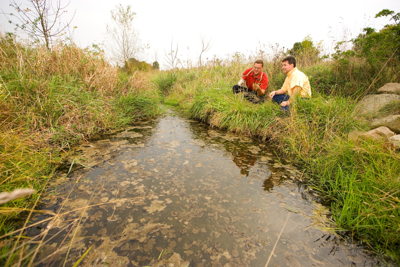 Two tiered drainage ditch along stream helps with erosion and filtering sediment on northeast Ohio organic farm.
Practice Type: Structural
Landuse/Agriculture Type: Row Crop
Climatic Zones: Temperate
Regions: North America, Europe
Pollutants Treated: Nitrogen
Description: A two-stage ditch is an alternative to the traditional trapezoidal drainage ditch design. It contains an inset channel at the bottom that passes the channel forming flow and floodplain benches on either side that convey less frequent, high-discharge events. The objective of this BMP is to mimic the function of natural systems. It mimics sediment transport characteristics of natural streams, removes nitrogen and improves habitat. 1
Implementation Considerations: A two stage ditch may require additional land on either side of the ditch to accommodate the width of the floodplain benches. A hydrologic analysis should be conducted to determine downstream hydrologic impacts. Construction should be planned for low-flow periods.
Scalable to small farms? No
Scaling Considerations: This can be a costly practice that takes land out of production and requires machinery for construction.
1 Miller, T. P. , J. R. Peterson, C. F. Lenhart, and Y. Nomura. 2012. The Agricultural BMP Handbook for Minnesota. Minnesota Department of Agriculture.
Urease Inhibitors
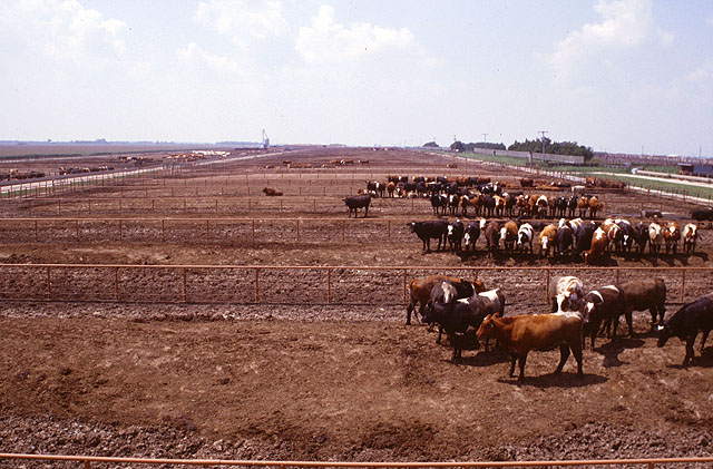 Preliminary experiments show that weekly applications of a urease inhibitor on feedlot surfaces such as this one blocks ammonia production in manure, thus preserving nitrogen and reducing emissions. Photo by John Nienaber. Photo Courtesy of USDA ARS.
Practice Type: Management
Landuse/Agriculture Type: Row Crop, Small Grains, Pasture, Fodder
Climatic Zones: Temperate, Semiarid, Tropical
Regions: North America
Pollutants Treated: Nitrogen
Description: Urease inhibitors slow the conversion of urea to ammonia and help reduce volatilization. Urease inhibitors target nitrogen fertilizer sources that have high volatilization potential (e.g. urea) in situations where tillage incorporation is not possible (e.g., no-till, pasture, and grass hay production). Adding a urease inhibitor allows more time for rain to incorporate the N fertilizer. 1
Scalable to small farms? Yes
Scaling Considerations: Cost and availability may be limiting factors for application on small and disadvantaged farms.
1 "Enhanced-Efficiency Nitrogen Sources." Agronomy Fact Sheet Series; Fact Sheet 45. Cornell University Cooperative Extension, 2009. http://nmsp.cals.cornell.edu/publications/factsheets/factsheet45.pdf
Vegetated Open Channels
Category: Filtration, Infiltration
Practice Type: Structural
Climatic Zones: Temperate
Regions: North America
Pollutants Treated: Nitrogen, Phosphorus, Sediment
N Efficiency1: 10-70%
P Efficiency1: 10-75%
S Efficiency1: 50-80%
Description: Vegetative open channels are practices that convey stormwater runoff and provide treatment as the water is conveyed. Runoff passes through either vegetation in the channel, subsoil matrix, and/or is infiltrated into the underlying soils. Typically, channels are constructed for conveyance with treatment occurring as water is conveyed. Channels designed for infiltration are known as bioswales.2
Implementation Considerations: Design calculations must be done by a qualified engineer familiar with hydrology and hydraulics. This practice will have detailed design standards for slope, velocity, infiltration rates, width, residence time, manning n value, maintenance, pipe placement,soil amendments, and various other design elements.
Scalable to small farms? No
1 "Documentation: Source Data, BMP Effectiveness Values." Chesapeake Assessment Scenario Tool. Web. 2013. http://casttool.org/Documentation.aspx .
2 Simpson, Thomas, and Sarah Weammert. "Developing Best Management Practice Definitions and Effectiveness Estimates for Nitrogen, Phosphorus and Sediment in the Chesapeake Bay Watershed." Chesapeake Bay Program. Dec. 2009. Web. June 2013. http://archive.chesapeakebay.net/pubs/BMP_ASSESSMENT_REPORT.pdf.
Water and Sediment Control Basin
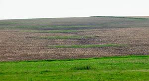 Looking upslope at a series of parallel water and sediment control basins built across a small watercourse on a cropped hillside. Photo courtesy of MN NRCS.
Practice Type: Structural
Landuse/Agriculture Type: Row Crop
Climatic Zones: Temperate, Semiarid, Tropical
Regions: North America, Europe
Pollutants Treated: Phosphorus, Sediment
P Efficiency1: 80% (Sediment In-bound P)
S Efficiency1: 92%
Description: Water and sediment control basins (WASCOBs) consist of an embankment across the slope of a field or minor waterway to temporarily detain and release water through a piped outlet or through infiltration. They are constructed perpendicular to the flow direction and parallel to each other. WASCOBs are usually installed in areas where the land is relatively steep and undulating. They detain water from contributing areas, inducing sedimentation and controlling the release of water, thereby reducing the erosive power of the water downstream. Additional benefits are settling of sediment-bound pollutants and some infiltration.2
Implementation Considerations: Generally, WASCOBs are constructed where the combination of topography and soils would lead to watercourse or gully erosion or otherwise damage the land. WASCOBs should be designed such that the extent and duration of ponding does not damage crops. Other key considerations in WASCOB design include the fill height of the embankment and the drainage area. The fill height of the embankment is dependent on the spacing between WASCOBs.
Scalable to small farms? Yes
1 Miller, T. P. , J. R. Peterson, C. F. Lenhart, and Y. Nomura. 2012. The Agricultural BMP Handbook for Minnesota. Minnesota Department of Agriculture.
2 Miller, T. P. , J. R. Peterson, C. F. Lenhart, and Y. Nomura. 2012. The Agricultural BMP Handbook for Minnesota. Minnesota Department of Agriculture.
Wet Pond
Category: Detention, Filtration
Practice Type: Structural
Climatic Zones: Temperate
Regions: North America
Pollutants Treated: Nitrogen, Phosphorus, Sediment
N Efficiency1: 20%
P Efficiency1: 45%
S Efficiency1: 60%
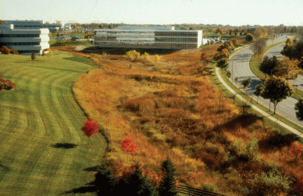
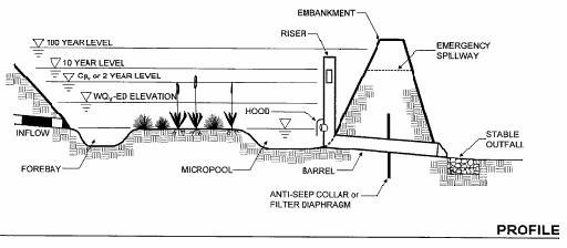
Description: Wet ponds (also known as retention basins) are man-made features for management of stormwater runoff. Wet ponds are basins created by excavation or berm construction that receive sufficient water via runoff, precipitation, and groundwater to contain standing water year-round at depths too deep to support rooted emergent vegetation. The permanent pool usually results in retention times sufficient to allow settlement of some portion of the intercepted sediments and attached nutrients/toxics. The captured stormwater runoff is released to an open water system at a specified flow rate. 2
Implementation Considerations: Properly designed wet ponds require very little maintenance. Ponds should be designed in a manner that reduces habitat for breeding mosquitoes. Wet ponds are usually inappropriate in dense urban areas due to their space requirements.
Scalable to small farms? No
1 "Documentation: Source Data, BMP Effectiveness Values." Chesapeake Assessment Scenario Tool. Web. 2013. http://casttool.org/Documentation.aspx .
2 Estimates of County-level Nitrogen and Phosphorus Data for Use in Modeling Pollutant Reduction Documentation for Scenario Builder Version 2.2." Chesapeake Bay. Dec. 2010. Web. May 2013. http://archive.chesapeakebay.net/pubs/SB_V22_Final_12_31_2010.pdf.
